Who or what is Dutchsinse?

Dutchsinse is one person, Michael Janitch (from St. Louis Missouri) , an independent scientist who has been researching / teaching topics related to geophysics. His studies are known to be controversial, and thought provoking. Dutchsinse has been humorously described as a ‘conspiracy theorist’ by some due to the controversial nature of the subject matter, and yet he has formed a strong base of science loving skeptic minded viewers around the world thanks to community support in his earthquake forecasting methodology.
Dutchsinse has discovered and proven the ability to forecast earthquakes using various tools, and methods to check on seismic activity. Since 2010, Dutchsinse has found a pattern and progressive movement in seismic activity across the globe. He has been able to forecast where earthquakes are likely to strike by looking at previous movement while comparing to “silent zone fulcrum points”. He has also worked out a way to calculate magnitudes to strike within each “silent zone” at its fulcrum. Dutchsinse has been described by many viewers (and critics) as 85% accurate in a weeks forecast. But as explained in the FAQ
Dutchsinse sites here:
http://www.dutchsinse.live
https://www.youtube.com/dutchsinse
https://www.dutchsinse.com
http://www.facebook.com/dutchsinseofficial
http://www.twitter.com/dutchsinse
EARTHQUAKE 3D SOFTWARE
What is EQ3D?

EQ3D (Earthquake 3D) is a downloadable software of an interactive 3D globe which works on most PC’s and mobile devices.
Earthquake3D features live feeds from various seismic agencies shown realtime, visually on a globe. The software has been created by Richard Wolton at http://www.wolton.net/
Where can I get EQ3D?
Visit: http://www.earthquake3d.com/
A free copy can be downloaded or the enhanced version for about $20.
What do the red and white rings mean?
The darker the red ring means the older the earthquake shown up to 7 days old. White is within the past day.
What are the numbers?
The numbers above the rings indicate earthquake magnitude (M0.0 to M9.9 range)
What does the green highlight mean on the magnitude number?
The green placemark indicates the most recent reported earthquake.
What does the blue highlight mean on the magnitude number?
This is the last earthquake which Dutchsinse clicked on for research.
Which are deep earthquakes on EQ3D
Deep earthquakes are shown raised high of the globe.
DUTCHSINSE VIDEOS
Why don’t you do text updates?
Dutch has done text work on his websites but his website then got blocked, shut down, and even listed as a threat on the DHS website at one point. This has lead to a real time live stream where daily forecasts are posted directly to the world with little interference possible from outside sources.
Dutch will be doing text updates early 2017.
Videos are too long.  Why?
Why?
Each location on the planet receives at least 5-10 minutes of coverage. Since there are at least 6 continents which need daily coverage, the daily update usually takes between 40min to 60min depending on daily activity.
YOU CAN FAST FORWARD any video to see the regional update for your location.
You can skip to what is relevant to your area but take into account that studying the whole globe will help you see what is coming your direction from across the planet. Each nights detailed explanations are designed to benefit viewers knowledge while doing their own research.
I missed the live update and it wasn’t recorded. Can I still see it?
There are 3 ways, Visit Dutchsinse’s You Tube Channel to see if he has uploaded it, Or try Coppertropicals’s channel.
Lastly if you load the live stream, you can scroll back the past 3 hours. http://www.dutchsinse.live
LEARNING TO FORECAST
Where can I learn to Forecast?
Here is Dutchsinse’s video on
How to Forecast and Earthquake: https://www.youtube.com/watch? v=vTMit7Y9SI0
What do Deep earthquakes do?
Deep earthquakes occur in an area called the “asthenosphere”, even though these earthquakes are not felt by humans, these deep events place upwards pressure on the underside of the plate(s) causing shallower larger earthquakes (up to 1-2 magnitudes larger).
Shallow larger earthquakes can strike in the same location as the deep earthquake, or the nearest silent zone fulcrum point.

There is additional compensation movement of similar size which occurs on the OPPOSITE side of the Pacific plate when a large ORdeep earthquake occurs.
Imagine the deep earthquake like a lava lamp ball rising up to the crust of the earth. Deep earthquakes can be recorded up to 750km. Asthenosphere deepest is 660km.
How many EQ’s does it take to be called a swarm?
Five or more earthquakes in a single location within 1 days time
Why do we think Earth has a Plasma Core and not solid metal one?
magnetic field emitted far into space
heat great enough to melt every element to liquid state
electrical charge fed by a steady stream of charged particles from the Sun (solar system, and possibly even greater areas)
connection to solar flares electron cascade
wave reflection like a solid, but oscillation like electrical energy
What is USGS & EMSC?
USGS is the largest US agency that report earthquakes globally.
EMSC is the European equivalent.
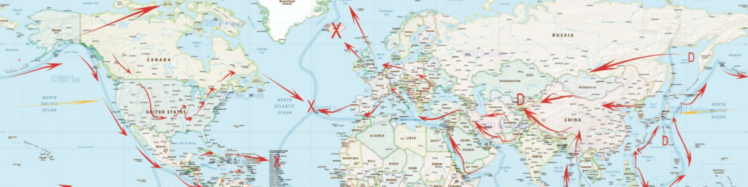
I’m in Europe, which way do Earthquakes move?
Use the GSPT Map to see the progression. Europe will travel East to West and West by Northwest.
How will I know if I am affected?
Have a glance at the livestream of live reports of earthquakes around the world here: http://www.dutchsinse.live
Use the map in the following link to make yourself familiar with where you are compared to the directional seismic progression of where earthquakes develop, and where they will strike next. :https://www.dutchsinse.com/1128201 6-global-seismic-pressure-tran sfer-map-which-way-does-the- planet-really-move/
How do I work out magnitude?
Earthquake magnitude can be forecast in a silent zone , more specifically at the fulcrum point of the silent zone.
Fulcrum point magnitudes are determined by rough addition of the magnitudes on each side of the silent zone.
Ten M1.0 = One M2.0
Ten M2.0 = One M3.0
Ten M3.0 = One M4.0
Ten M4.0 = One M5.0
Ten M5.0 = One M6.0
Ten M6.0 = One M7.0
Ten M7.0 = One M8.0
Ten M8.0 = One M9.0
Every magnitude consists of 10 “points” between … such as M2.1, M2.2, M2.3, M2.4, M2.5, M2.6 etc……
Addition of magnitudes is simple rough addition, thus :
M2.0 + M2.0 = M2.2
M2.0 + M2.0 + M2.0 = M2.3
M2.0 + M2.0 + M2.0 + M2.0 = M2.4
And so on…..
Addition of magnitudes with “points”: ADD THE MAGNITUDE FIRST – then add the “points”
M2.1 + M2.2 + M2.3 = M2.6
When adding magnitudes of different power (M2.0’s + M4.0’s for instance): Remember the rule of magnitudes being 10 fold apart — it takes 10 different M2.0’s to equal a M3.0 , and it takes 10 different M3.0’s to equal a M4.0 (and so on).
M2.5 + M4.7 + M5.8 = M5.9725
The M4.7 adds on a 0.1 to the M5.8 being that it is 1/10th of a M5.0
The 0.7 remaining from the M4.7 is added to the hundreths portion of the magnitude.. then the M2.5 adds on an addition insignificant thousandths of a decimal on to the total magnitude (0.0025) to the M5.98 .. making the total earthquake potential 5.9725 – or better put rounding up to an even M6.0 if issuing a forecast to the public.
What if a quake doesn’t seem to follow the progression?
This either means there is a bounce back or reflection from a series of earthquakes in a new area, volcanic activity is interfering with seismic progression, man made activity is interfering via pumping operations (gas, oil, and geothermal), solar events have changed suddenly, space weather events have shifted, or a calculation error was made.
How did Dutch come to this conclusion of progression?
7+ years of research using the EQ3D software , together with a series of serendipitous discoveries in relation to plasma physics, and geophysics, along with the use of a 3 dimensional globe used to plot these events, Dutchsinse has been able to see the visual progression which seismic pressure takes as earthquakes strike across the planet.
How far do you look for movement after a Deep EQ?
Look within 1000km-1500km away as a standard rule of thumb, however distance is not a factor in the fulcrum points, or silent zones. Some larger silent zones have been 8,000+ miles (10,000+ km across). The fulcrum point in the silent zone will be hit regardless of the large distance apart.
FORECASTING IN THE AMERICAS
Will California fall into the ocean?
With pressure coming from the west, the Pacific plate is pushing into the US , instead of going under the US , the pressure transfers laterally across the West coast all the way to the Midwest United States (even to the East coast in some instances).
California is rising, and will continue to rise. There is no place in the Ocean for California to “fall into”, thus California will never fall into the ocean, or sink into the ocean.
If a large earthquake strikes California, or off the West coast.. the West Coast will RISE not fall. This is good news.
What is the sequence of movement for West Coast USA? What are the warning signs of a coming earthquake along the West coast of the United States.
The signs of a coming earthquake off the West coast of the United States are obvious once you know what to look for.
1st : As pressure builds along the West coast of the US (coming from the Pacific Plate), the western portion of the United States (California, Nevada, Utah, Wyoming, Washington, and Oregon) will begin seeing swarms of smaller earthquakes (M1.0 to M4.0) occur at multiple ancient volcanic magma chambers interior to the coast.
After the magma chambers are struck, the pressure reaches upwards to the next weakest point it can find to release at. Usually this means the fracking, deep oil drilling, geothermal, and other man made penetrations into the crust are struck (deep perforations in the solid plate).
Finally, the last warning sign BEFORE movement occurs off the coast — the pressure seeks its way upwards even further beyond the manmade pumping operations, and finally strikes the fault zones at a shallow depth (just below the surface).
Once pressure reaches the fault zones , after already hitting the pumping operations, and dormant volcanoes — the pressure has nowhere to go , the zone becomes “locked”, and then quickly (within days) releases off the coast with a greater earthquake .
The earthquake which strikes is usually a combination of the total number of earthquakes (both small and large) which struck the region in the prior 3 days leading up to the event.
When will Yellowstone blow?
It will take a VERY large earthquake (9+?) to occur to the West or Northwest of Yellowstone Volcano. There will be early signs in global activity that will tell us what to watch for weeks in advance.
When is the San Andreas Fault going to collapse???
See “will california collapse into the ocean” question above — simply put — it will not collapse — but it will rupture at some point in the future along the plate boundary, and will cause an earthquake similar to what struck New Zealand, or Italy this past year in 2016.
Why is Oklahoma being struck with more earthquakes?
Oklahoma has a series of oil wells that surround the entire state which are now been reused for fracking wells. Additionally, new fracture wells have been put in to this day with freshly drilled locations used for new gas extraction. Fracture wells have been installed too close to one another, and professionals did not take seismic pressure transfer from the West coast / Pacific into account when authorizing this much drilling across the edge of the North American Plate.
These multiple thousands of fracture points have led to multiple state wide ‘Super Fractures’, a term that Dutchsinse had to create to describe what happens when a large fracking earthquake fractures other nearby gas wells, which causes additional earthquakes in a domino effect..